I am able to get the contour lines for my farm using SketchUp, its just a matter of locating your filed on google earth via SketchUp import, hit the toggle terrain button and you have the 3d image with proper elevation. This video, youtube.com/watch?v=y4J9sWEZR6E , helped me to get there.
Now the question of accuracy, and then how to really map to your farm. Trying to get there…
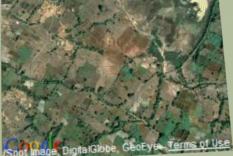
Thanks Hedge, this is a good find. I was able to generate the lines using SketchUp as attached, which kind of matches what I did manually in google earth. Unfortunately we don’t have high resolution elevation data for India or using it in qgis would have been a breeze.
I think we can use this map as a guide for speeding up work with an A frame or water pipe methods for actual field marking. The data for my area is from 2009 and is in 1m intervals and hence would no more be an indication.
I have also looked at how dumpy levels, laser levels and total stations work but looked like an A frame is the simplest (and most economical). My plan is to pick some of the contour lines to create swales across the farm. My borewell drilling exercise last week has not been too encouraging.
P.S.: Brijesh, I am still to look at the links you provided, thanks.
If you need to calculate area, record the track using GPS, export measurements to different formats, see your farm on Google Maps or Bing please check out this Android app: